Big Sur Road Conditions and Driving Tips
Road Conditions
Highway 1 hugs very fragile hillsides in the Big Sur region. Mud and rock slides are common, especially in the winter and spring, and these can close Highway 1 for extended periods. The area between Lucia and Gorda is especially prone to damaging slides. Do not enter the Big Sur region without checking current road conditions.
You can easily obtain current conditions on California Highway 1 ("SR1") from the California Department of Transportation (Caltrans):
- Current conditions on Highway 1
- Current conditions on any California highway
- Web site
- 800.427.7623 (touch-tone within California only)
- 415.557.3755 (touch-tone only)
- 213.628.7623 (touch-tone only)
- 916.445.1534 (rotary phones OK)
Here are a few notes to help you understand the Caltrans information:
Caltrans reports road conditions by highway number. Because Highway 1 ("SR1") is very long, Caltrans groups conditions by geographic region in its report for this highway. Many reported conditions on Highway 1 may be outside the Big Sur region. Caltrans groups the Big Sur region's highway conditions under a "Central California" heading. For the purposes of travel within the Big Sur region, then, you can ignore conditions on Highway 1 outside the "Central California" heading. In the following example, the road closure under the "Central California" heading is indeed in the Big Sur region, but the closure under the "Northern California Area" heading is not:
Sample Highway 1 Conditions Report
[IN THE SOUTHERN CALIFORNIA AREA]
NO TRAFFIC RESTRICTIONS ARE REPORTED FOR THIS AREA.
[IN THE CENTRAL CALIFORNIA AREA]
IS CLOSED 2 MI SOUTH OF GORDA (MONTEREY CO) - DUE TO A SLIDE - MOTORISTS ARE ADVISED TO USE AN ALTERNATE ROUTE
[IN THE NORTHERN CALIFORNIA AREA]
IS CLOSED FROM MONTARA TO PACIFICA (SAN MATEO CO) - DUE TO A SLIDE - MOTORISTS ARE ADVISED TO USE AN ALTERNATE ROUTE
The Caltrans reports sometimes refer to counties as well, so it may help you to know that the Big Sur region lies almost entirely within California's Monterey County, and a small portion of its southern end, from just north of the Ragged Point Inn vicinity southward, is in San Luis Obispo County. If the Caltrans report refers to conditions at certain distances north or south of "Big Sur", you can assume it means Big Sur Station in the Big Sur River valley.
Driving Tips
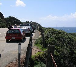
California Highway 1 in the Big Sur region is one of the state's most dangerous highways, even in good weather. It is narrow (almost entirely one lane in each direction), and travelers who are driving slowly or have stopped entirely, directly on the highway, to admire the view can pose hazards to other drivers. Please keep these laws and tips in mind:
- Drive defensively.
- Wear your seat belt. It's the law.
- Obey posted and unposted speed limits. State law provides that, unless otherwise posted, the maximum speed limit is 55 mph (about 88 kph) on two-lane undivided highways such as Highway 1 in the Big Sur region. Do not drive faster than is safe under the road and weather conditions. The maximum safe speed may be slower than the posted speed limit.
- Motorcyclists must wear helmets. Bicyclists under age 18 must wear helmets. It's the law. (All safe and sane cyclists of all ages wear helmets anyway.)
- It is a good idea to drive this highway with your headlights turned on at all times, regardless of the time of day or weather conditions, to make your vehicle more visible to oncoming vehicles. (Turn your lights off when you turn off the ignition!) The California Driver Handbook advises that you should never drive with only your parking lights or fog lights turned on and that your headlights must be turned on whenever weather conditions require the use of your windshield wipers.
- Keep your eyes on the road. If you want to enjoy the scenery, and you will, use one of the hundreds of marked and unmarked turnouts.
- If there is no vehicle immediately in front of you and five or more vehicles are immediately behind you, state law requires that you pull to the side of the road, where you can do so safely, and allow the vehicles behind you to pass. When pulling over, avoid quick stops on unpaved shoulders.
- The law aside, you do not lose face by pulling off the highway and allowing other traffic to pass you. This is not a driving competition. You are in Big Sur. Relax. There are hundreds of places along the highway that allow you to stop and look. Do so often.
- Do not cross the center line to pass vehicles ahead of you if the center line is double yellow or is solid yellow on your side, or if your visibility ahead is impaired.
No diesel fuel is available within the Big Sur region. Fill up in the Monterey/Carmel area on the north end or in Cambria on the south end.
You can view and print a table of marker and ends values for all the Big Sur locations described in this Web site. (See Along the Highway: About Locations on California Highway 1 for an explanation.) The table will be useful to have in hand as you drive through the Big Sur region.


