Along the Highway
Bixby Creek Bridge / Coast Road (north end)
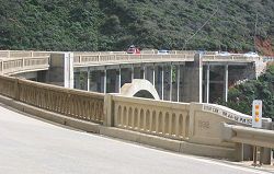
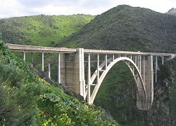
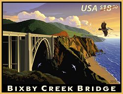
Bixby Creek Bridge is probably the most famous of Big Sur's Highway 1 bridges, and most observers consider it to be the most beautiful.
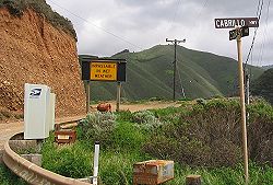
The north end of the Coast Road is located at the bridge's north end. This unpaved road travels inland, bypassing the mouths of Bixby Creek and the Little Sur River, crossing their canyons at higher elevations. A high-clearance vehicle is required, and a 4-wheel drive vehicle recommended. Before Bixby Creek Bridge and other parts of Highway 1 were completed, this route was the only road that reached the Big Sur Valley. The south end of the Coast Road is opposite the entrance to Andrew Molera State Park.
Reference
- Bixby Creek Bridge, Monterey County Historical Society
Activities, Facilities, and Services
- Public Transit stop (seasonal)
- Scenic Vistas
- Wildlife Viewing
- Bridges
- Bicycling - Bike Trails: Mountain biking on the Coast Road
Location
- Marker: MON 59.8
- Ends:
- 13 miles (20 km) from N
- 76 miles (123 km) from S
- Geo: Lat N 36° 22.346 Lon W 121° 54.161
- Google map
- Aerial coastal photos
Has this Web site, A Guide to California's Big Sur, been worth something to you as you plan a trip to Big Sur -- maybe fifty cents? a dollar? If so, you can, if you wish, contribute that amount to help defray this site's costs. Learn how.


