Along the Highway:
Location Files for California Highway 1
The Geo information in this Web site's Along the Highway pages gives each point's geographical location to very good precision (within a few feet). These "waypoints" or "POIs" (Points of Interest) will be useful for visitors with GPS devices, smartphones, or topographical mapping software.
Those with GPS devices or with National Geographic's TOPO! software can download files containing this Web site's waypoints that can be used with those devices and software.
.GPX File
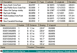
Waypoint (or POI) files contain lists of waypoints and other information. Software applications that read waypoint files in the .gpx format can be used to sort and review the waypoints, determine distances between them, organize them into routes, and upload them into GPS devices. The Web site geocaching.com includes a page that describes waypoint files and lists software applications that read them. Some of those software applications are free, including EasyGPS for Microsoft Windows, which I used to create this site's .gpx file.
Download this Web site's .gpx file here:
.LOC File
The .loc format is an older waypoint file format.
Download this Web site's .loc file here:
.TPO File
Files in the .tpo format contain user information used by National Geographic's TOPO! software to display topographical maps. A TOPO! software user who has TOPO! data for the Big Sur region and who opens this Web site's .tpo file will see the Along the Highway waypoints superimposed on the topographical maps.
Download this Web site's .tpo file here:


