Along the Highway
Andrew Molera State Park / Coast Road (south end)
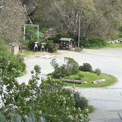
Andrew Molera State Park is the Big Sur region's largest state park, though much of its area is accessible only to hikers, bicyclists, and equestrians who use the park's miles of trails. This park has a campground that is not accessible to vehicles; you must walk in or ride your bicycle in. For more detailed information, see the resources listed on the Books and Maps page.
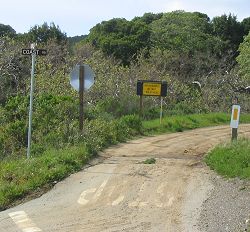
The south end of the Coast Road is located across Highway 1 from the entrance to Andrew Molera State Park. This unpaved road travels inland, bypassing the mouths of Bixby Creek and the Little Sur River, crossing their canyons at higher elevations. A high-clearance vehicle is required, and a 4-wheel drive vehicle recommended. Before Bixby Creek Bridge and other parts of Highway 1 were completed, this route was the only road that reached the Big Sur Valley. The north end of the Coast Road is at the Bixby Creek Bridge's north end.
Reference
- State park vehicle day use fee (walk-ins are free)
- Information 831.667.2315
- Related Web sites
- Andrew Molera State Park, California State Parks
- Ventana Wildlife Society
Activities, Facilities, and Services
- Camping - Campgrounds: State Park Campground
- The campground is in a meadow on the north side of Big Sur River. A trail provides access to the nearby ocean beach.
- No reservations accepted (first come, first served)
- no vehicle access; walk or bike in only
- Picnic Areas
- Restrooms
- Ranger Stations
- Public Transit stop (seasonal)
- Scenic Vistas
- Wildlife Viewing
- Ventana Wildlife Society Big Sur Discovery Center 831.624.1202
- Hiking and Backpacking: 20 miles of trails
- Bicycling - Bike Trails: Mountain biking on the Coast Road and on three trails in Andrew Molera State Park
- Horseback Riding
- Molera Horseback Tours 831.625.5486 / 800.942.5486
- Coastal Access
- Fishing: river and ocean
- Swimming: river
- Surfing: Big Sur Rivermouth
- Historical Interest
- Molera Ranch House Museum
Location
- Marker: MON 51.2
- Ends:
- 21 miles (34 km) from N
- 68 miles (109 km) from S
- Geo: Lat N 36° 17.303 Lon W 121° 50.667
- Google map
- Aerial coastal photos
Has this Web site, A Guide to California's Big Sur, been worth something to you as you plan a trip to Big Sur -- maybe fifty cents? a dollar? If so, you can, if you wish, contribute that amount to help defray this site's costs. Learn how.


